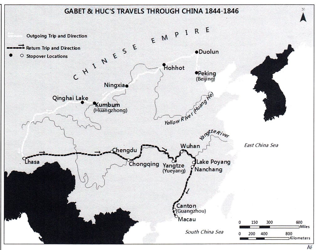
Gabet and Huc’s travels through China, 1844-1846 by Aaron Faulkner.
As part of his GEO 398: Internship focusing on Digital Humanities and Historical GIS, under the supervision of St. Vincent de Paul Professor Alex Papadopoulos, undergraduate student Aaron Faulkner has been transforming narratives from the Vincentian archives into maps. This map was created for the fourth volume of The Vincentians, A General History of the Congregation of the Mission, to be published in the spring of 2014. Aaron’s map shows the 1844-1846 travels of the French Vincentian missionaries Evariste Regis Huc, C.M., and Joseph Gabet, C.M., through the Chinese Empire, including Inner and Outer Mongolia, Tibet, and Portuguese Macau. The outgoing trip, shown in white, took the missionaries to seven stopover sites, traveling across plains, steppes, and eventually the Himalayas. From Lhasa they traveled east following the Yangtze River wherever possible before heading south and terminating their trip in Macau. This cartographic reference was created by studying period maps and extracting key data, in the form of trails, text, and place marking to create a contemporary rendering with the help of digitization.
For more information contact: Prof. Euan Hague, Chair, Department of Geography, ehague@depaul.edu; Prof. Alex Papadopoulos, Department of Geography, apapadop@depaul.edu.