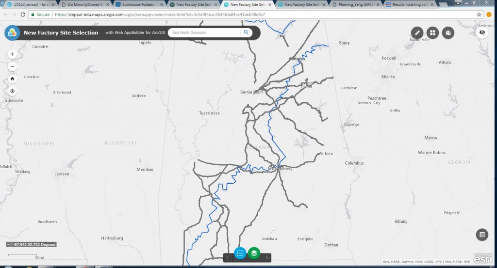
The above web app features widgets that allows users to select sites by being able to let them input their own distance parameters to the features on the map and then executing it by using a GIS model that was created in ArcMap. The other widgets allow the user to change base maps and a measuring tool that can measure area or distance in the map. The data types are line data of railroads and rivers in the state of Alabama.
https://depaul-edu.maps.arcgis.com/apps/webappviewer/index.html?id=3c9a9f5bac3644fda84ce41aeb48e8c7
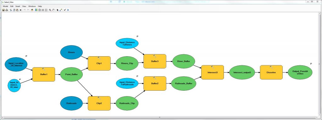
This model used in the above web app was created using the ModelBuilder in ArcMap features a complex process utilizing the tools: buffer, clip, intersect, and dissolve. The buffer tool creates a buffer around the input data that is directly connected to it in the model, while the clip tool extracts the input features (rivers, railroads, andpoint buffer) that overlay the clip features, the intersect tool extracts input features that overlay each other, and the dissolve tool merges adjacent little input feature polygons into bigger ones. The input data are colored blue, while the tools/operations are yellow, and the output data are green. Certain input data and variables are given model parameters to allow users to input their own values in the web app utilizing the model.